
A
Accomack County - Created in 1672, formed out
of the northern part of Northampton County. Northernmost of Virginia's
two counties that form Virginia's Eastern Shore. It is bounded
to the north by the State of Maryland, to the east by the Atlantic
Ocean, to the west by the Chesapeake Bay and to the south by Northampton
County, VA. Its greatest length is about 48 miles along a north/south
axis and its mean width is 10 miles. It is about 480 square miles.
Population: 1820~~15,966 // 1830~~19,656 // 1990~~31,703
Accomac - previously known as Drummondtown, now serves as the county seat. The Post Office was established here on 12 Jun 1792 as Accomac Court House. Click HERE for more information on Drummondtown / Accomac.
Allentown - se part of the county on the seaboard side, e of Onley
Ann's Cove - on the bay side at Guilford Creek where it enters the bay.
Assateague Bay - small body of water between Assateague Island and Chincoteague Island and north of Morris Island
Assateague Island - a long barrier island in the ne part of the county, divided by the Maryland line. To the w of the island is Chincoteague Island and the community of Chincoteague. The island now forms the Assateague Island National Seashore.
Assawoman Creek - a large creek in ne part of county, seaside, emptying into Woman's Bay at the sw part of Wallops Island. It is the Indian word for Rock Cave.
Assawoman Inlet - a small inlet between the ne tip of Assawoman Island and sw tip of Wallops Island
Assawoman Island - a barrier island on the seaside, ne part of county, between Wallops Island and Metompkin Island. Hog Neck lies to the west on the mainland
Atlantic - ne part of county, n of Wishart and e of Temperanceville
B
A / B / C
/ D / E / F
/ G / H / I
/ J / K / L
/ M / N / O
/ P / Q / R
/ S / T / U
/ V / W / X
/ Y / Z
Back Cove - a small cove in nw part of county between Freshschool Marsh and Tunnels Island
Back Creek - a small creek flowing into the Bay through Parkers Marsh
Bagwell Creek - a tributary to the Chesapeake Bay, merging with Hunting Creek at The Thoroughfare
Bailey Neck - a jut of land into Onancock Creek bounded by the said Creek and Finneys Neck
Baylys Neck - in the middle of the County on the seaboard side, between Parker Creek to the north and Jones Neck to the s, and e of Accomac
Bayside - middle of the county, on the bayside, w of Greenbush
Beach Island - a small Island in the Bay, nw of Rogue and Tobacco Islands
Beasley Bay - a small bay of the Chesapeake Bay, nw part of county
Belinda - a small community in nw part of the county, n of Messongo Creek and south of Sanford. A post office operated here until 1940.
Bell Haven - southern portion of county near Northampton line, just west of Bell Haven Station. Began as Bell's Oven, named for a large oven in the area. In 1774 it was sold as 148 acresincluding the Tavern called Bell Haven
Bell Haven Post Office - located in the se part of the county.
Bell Neck - a large jut of land located between Parting Creek and the Machipongo River, se part of county
Bethel Branch - a tributary to Muddy Creek, nw part of county
Bloomtown - see Makemie Park
Bloxom - small community in nw part of county, on Rt. 316, n of Parksley and Guilford Church Branch
Bluff Point - a mall point of land on the nw part of Hacks Neck, sw part of county.
Bobtown - sw part of county, between Melfa and Boggs Warf, and w of Hollies Church Branch
Bogues Bay - ne part of county, between the mainland and Wallops Island and Wishart
Boggs Warf - sw part of county, w of Melfa and on Pungoteague Creek. A Post Office was established here in 1879 as Boggs Warf, Frank T. Boggs, Postmaster and reneamed in 1894 as Boggs; but discontinued in 1913.
Boston - sw part of the county, sw of Pennyville at Fairview Neck
Bradford Bay - body of water in se, east of Bradford Neck, near Wachapreaqgue
Broadway Neck - a large neck of land on the bayside, sw part of county, bounded by Onancock Creek and Matchotank Creek
Bull Branch - a tributary to Pungoteague Creek, sw part of county
Bull Cove - a small cove in Scarborough Neck entering the Bay.
Bulls Town - see Hyslop
Bullbeggar - nw part of county, s of Bullbeggar Creek and w of Whithams. A post office operated here 1894-1935
Bullbeggar Creek - a tributary to Pocomoke Sound, nw part of county
Bundick Creek - small creek in middle of county, seaside, between Parker Neck and Whites Neck, emptying into nw corner of Metompkin Bay. Its headwaters are near the village of Metompkin and goes SE to the north end of Metompkin Bay at about L75d35m lat 37d45m.
Burton's Bay - large bay in se part of county, south of Custis Neck and Cedar Island
Burtons Shore - se part of the county on Burtons Bay, just s of Custis Creek
Byrds Marsh - located between Muddy Creek and Cattail Creek, nw part of county
C
A / B / C
/ D / E / F
/ G / H / I
/ J / K / L
/ M / N / O
/ P / Q / R
/ S / T / U
/ V / W / X
/ Y / Z
Cashville - sw part of county, between Finneys Neck and Broadway Neck. A Post Office operated here from 1885 to 1909.
Cats Bridge - extreme se part of county, s of Coal Kiln and w of Bell Neck
Cattail Creek - a tributary to the Bay located between Byrds Marsh and Michael Marsh, nw part of county
Cedar Island Bay - small body of water in se part of county, between Custis Neck and Cedar Island
Cedar Straights - a body of water sepaarating the Eastern Shore and Chump Island.
Centerville - center of county on Rt. 13, se of Parksley and nw of Parker Neck
Chancetown - se part of county, between Rattrap Creek and Nickawampus Creek
Chandler Marsh - a marsh on the nw part of Sluitkill Neck, sw part of county
Chase Crossing - middle of county on the rail line, s of Parksley
Cheeseman Island - a small island north of Shanks Island and south of Smith Island.
Chesconessex - sw part of county and n side of Chesconessex Creek. A Post Office operated here from 1885 to 1911.
Chesconessex Creek - a tributary to Chesapeake Bay, nw of Onnacock
Chincoteague - a small town on Chincoteague Island, ne part of the county. Click HERE for more information on Chincoteague. A Post Office was established here in 1853.
Chincoteague Bay - a large bay between the shore and Chincoteqgue Island, ne part of county
Chincoteague Island - a large island, ne part of county, between Chincoteague Bay and Assateague Island
Chincoteague--View
from the Island - 
Chump Island - a small island in the Chesapeake Bay, nw part of county, at Cedar Straights and just below the state line.
Churches of Accomack County:
 Garrission Church Painter |
 St. Georges Church Pungoteague |
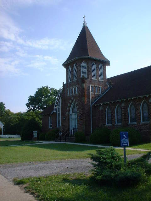 ???Methodist Ch, Accomack by Ray Griffin |
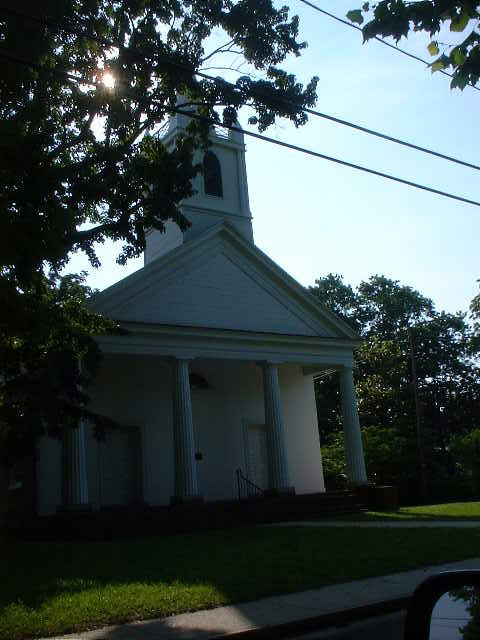 ???Episcopal Church Accomack by Ray Griffin |
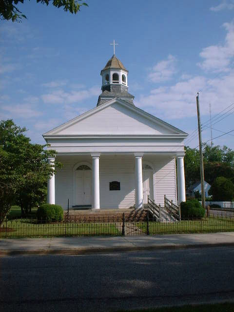 ???Presbyterian Ch. Accomack by Ray Griffin |
|
Clam - in nw part of county, n of Parker Landing and w of Hopeton. A Post Office operated here 1910-1914 and 1919-1934.
Coal Kiln - se part of county, s of Mappsburg and w of Moreland Swamp
Coal
Kiln Crossing - 
in extreme southern part of county on Rt.
13, n of Exmore and near Painter.
Cockie Point - on w side of Chincoteague Bay, e of Sinnickson
Coldkall Creek - small creek in ne part of county, south of and adjacent to Winders Neck, emptying into Chincoteaque Bay
Coocheyville - a small community on Hacks Neck, sw part of county.
Cod Harbor - a small body of water adjacent to the east side of Tanglier Island.
Craddock Creek - a creek on the bayside, sw corner of county, counded by Scarborough Neck and Craddock Neck.
Craddock Neck - a jut of land on the bayside, sw corner of county, counded by the Bay, Craddock Creek and Nadua Creek.
Craddocksville - sw part of county, on Craddock Neck
Crockett Town - sw part of county, n side of Pungoteague Creek and e of Sluitkill Neck
Crossroads - see Temperanceville
Crowsontown - see Justisville
Custis Creek - a small creek in se part of county, with headwaters rising east of Onley and empties into Burtons Bay on the seaside
Cedar Creek - a small tributary to Onancock Creek, west of Town of Onancock
Cedar Island - a large barrier island in se part of the county on the seaside, s of Metompkin Bay and n of Parramore Island
Cedar Point - ne tip of Cedar Island at Metompkin Inlet
Clam - nw part of county, w of Hopeton, e of Marks Island
Coards Branch - a small tributary to Hunting Creek, nw part of county
Cross Creek - a small creek, se part of county, connecting Folly Creek and Cedar Island Bay
Crossroads - see Onley, listed below
Custis Creek - se part of county emptying into Burtons Bay
Custis Neck - a body of land in se part of the county, bounded by Custis Creek to the w and s, and Folly Creek to the n, and w of Cedar Island
D
A / B / C
/ D / E / F
/ G / H / I
/ J / K / L
/ M / N / O
/ P / Q / R
/ S / T / U
/ V / W / X
/ Y / Z
Daugherty - se part of the county, e of Onley and n side of Custis Creek. A Post Office operated here between 1887-1969.
Davis Warf - a small community on Scarborough Neck on Occohannock Creek. A Post Office operated here between 1874-1993.
Deep Creek - a large creek flowing into the Bay, north of the Town of Onancock and adjacent to Savage Island
Doe Creek - a small creek flowing into the Chesapeake Bay, between Deep Creek and Hunting Creek
Dreka - nw part of county, on Pocomoke Sound n of Sanford. A Post Office operated here 1891-1909. The post office was at Shad Landing and named by the Postal Department.
Drum Bay - a small bay on the west side of Tunnels Island, nw part of county
Drummondtown - previous name for Accomack Court House, now Accomac. Click HERE for more information on Drummondtown / Accomac.
E
A / B / C
/ D / E / F
/ G / H / I
/ J / K / L
/ M / N / O
/ P / Q / R
/ S / T / U
/ V / W / X
/ Y / Z
East Point - a jut of land on the northern side of Broadway Neck on the Onancock Creek
Eastern Shore Public
Library - 
A regional library serving Accomack and Northampton
Counties. It has an excellent local history and genealogy room.
Located in Accomack on Business 13 north of the courthouse.
Eastern Shore of Virginia Produce Exchange - was chartered in 1900 in Onley during the boom years after the railroad had drastically cut the time and cost of transporting produce to consumers in Baltimore, Philadelhia and other large markets. In its hay day, with over 1600 stockholders, it handled over half of the produce grown here and regularly exported potatoes to Canada and Cuba. It was closed in 1955. I suspect the closing is coincident with the trucking industry becoming more competitive, allowing individual farmers to reach these markets on their own - or be reached by them. This is the time frame in which the Bay Bridge was built and passenger service on trains was terminated. (submitted by ghote Barton Bull)
Eliza's Flat - see Greenbush
Evans Warf - sw part of county, w of Onancock on Pungoteague Creek. A post office operated here 1884-1909.
F
A / B / C
/ D / E / F
/ G / H / I
/ J / K / L
/ M / N / O
/ P / Q / R
/ S / T / U
/ V / W / X
/ Y / Z
Fair Oaks - se part of the county and e of Melfa, a post office operated here 1884-1909
Finney Creek - in se part of county, east of Onley and merges with Rattrap Creek, on seaside
Finneys Island - a small island nw of Scarborough Island
Finneys Neck - a jut of land counded by Onancock Creek, Broadway Neck and Bailey Neck, sw part of county
Finneys Warf - a small community on the south side of Onancock Creek and east of Bailey Neck. Originally known as Finney, post office operated here 1881-1909
Fishbone Island - a small island just north of Goose Island, in the Chesapeake Bay.
Flag Pond Landing - originally known as Flag Pond, nw part of county n of Sanford; a post office operated here 1874-1875
Folly Creek - A large creek in se part of county, seaside, emptying in Metomkin Inlet, headwaters eastof Accomac
Fox Island - nw part of county on Pocomoike Sound and e of Tangier; post office operated here 1902-1915
France Creek - a small creek flowing into the Chesapeake between Peters Hammock and Simpson Point
Freeschool Marsh - a large marsh in nw part of county, bay side, between Messongo Creek and Pocomoke Sound
Frogstool Branch - a tributary to Machipongo River, in se part of county near Keller and Frogstool
G
A / B / C
/ D / E / F
/ G / H / I
/ J / K / L
/ M / N / O
/ P / Q / R
/ S / T / U
/ V / W / X
/ Y / Z
Gargatha - in the middle of the county, on Rt. 13 at the headwaters of Whites Creek and ne of Parksley; post office operated here 1888-1953
Gargathy Bay - small body of water, ne side of county on the seaside, between Gartathy Neck and Metompkin Island
Gargathy Creek - creek in middle of county, seaside, between Gargathy Neck and Hog Neck
Gargathy Neck - body of land in middle of county, on the seaboard side, between Whites Creek to the s and Gargathy Creek to the north, and west of Metopkim Island
Grape - on Rt 658 at Drummonds Mill Pond, a post office operated here 1897-1905. In 1664 Richard Hillnamed the place for wife mary Drake and word Grape probably became a corrupted version even though Thomas Wise meanwhile purchased it and renamed it Wiseville
Great Fox Island - a small island in the Chesapeake Bay, nw part of county, just south of Chump Island.
Great Thorofare - a body of water in the Chesapeake Bay separating Great Fox Island and Little Fox Islands.
Greenbush - middle of county, n of Accomac and e of Bayside; post office established here 1909, the RR station was Green Bush, previously known as Eliza's Flat until Stewart Mathias named the town after his evergreen bush.
Greta - ne part of county, e of Johnson's Corner; post office operated here 1902-1944
Grotens - a small community n of Messongo; post office oprated here 1897-1953
Goose Island - a small island just north of Tangier Island.
Grangeville - se part of county e of Keller; post office operated here 1884-1885 and 1887-1914
Graysville - middle of county between Onley and Accomac
Greensbackville - extreme ne part of county just below Maryland line, on w side of Chincoteague Bay; post office established here in 1874
Groton Town - northern part of county, n of Measrs Station and se of Hallwood
Guard's Shore - An area to the north of the mouth of Guilford Creek at Ann's Cove.
Guilford - nw part of county, on Guilford Creek and w of Bloxom; post office operated here 1840-1924
Guilford Creek - a large tributary to the Chesapeake Bay at Beasley Bay, west of Bloxom. Also known as Muddy Creek. To see this on a USGS map, click here: USGS Quad Map: Click Here
Guilford Church Branch - a tributary to Guilford Creek
Gum Branch - a tributary to Messongo Creek, nw part of county
H
A / B / C
/ D / E / F
/ G / H / I
/ J / K / L
/ M / N / O
/ P / Q / R
/ S / T / U
/ V / W / X
/ Y / Z
Hacks Neck - sw part of county, between Pungoteague Creek and Nandua Creek; post office established here 1910
Halfman Island - a small island in the Chesapeake Bay north of Webb Island
Hallwood - a small community in the north central part of the county, at the headwaters of Messongo Creek and west of Temperanceville; post office established here 1884
Hancock Branch - a tributary to Tunnels Mill Branch
Harborton - a small community on the ne part of hacks Neck in the sw part of the county, on Pungoteague Creek; post office established here in 1874 as hoffmans Wharf and renamed Harborton in 1891, James W. Hoffman was postmaster.
Hawks Nest - see Mappsburg
Helltown - "Helltown, at a cross road in the upper part of this county, and theretofore marked only by a rickety hut with a single inhabitant, has been bought by Messrs George parks and S. R. Nelson, will proceed at an early date, by the erection of dwelling houses, store house, blacksmith shop & c., to convert it into a first class business place. In the future it will be dignified by a name suggestive of less warmth, to wit, Nelson park." On 15 Feb 1883 a newspaper article printed: "A cross road in the upper part of our county, heretofore called Helltown, now goes by the name of Nelsonia, after Mr. Spencer R. Nelson, who has purchased most of the real estate thereabouts....."
High Woods - middle of county, between Chase Crossing and Centerville
Hoffmans Warf - see Harborton
Hog Creek - ne part of county, between sw end of Wallops Isand and Oyster Bay
Hog Neck - ne part of county, on the seaside, w of Assawoman Island and on w side of Kegotank Bay
Hollies Church Branch - a tributary to Warehouse Prong, and ultimately Pungoteague Creek.
Holdens Creek - a tributary to Pocomoke Sound, north of Grotons
Hopeton - nw part of county, n of Parksley and s of Mill Branch; post office operated here 1888-1965
Hopkins - nw part of county, on Hunting Creek, s of Justiceville; post office started in General Store of John Hopkins and hezekiah Fitzgerald and operated 1886-1970; see Wiseville
Horntown - located on a navigable sream (1836) by which vessels clearning 6-8" of water assend within a mile of town; post office operated 20 Mar 1793 - 21 Oct 1862 and reestablished 26 Dec 1862. Name first appears in 1744 when Daniel Gore petitions to build a road from a place called the Hornes. A later court order noted the cross roads by a placed called Horn Town (Whitelaw), A Gazetteer of 1835 puts it on the Postal Road leading to Snow Hill with a population of 150.
Horntown Bay - small bay in sw part of Chincoteqgue Bay
Horsey - nw part of county, on the rail line, w of Johnson's Corner; post office operated 1886-1985; destroyed by fire
Hummock Cove - small body of water, se, adjacent to Burtons Bay
Hungars Church - one of the oldest and most historical churches on Virginia's Eastern Shore, formed ca. 1645. For detailed information, click HERE
Hunting Creek - a tributary to the Chesapeake Bay, west of Whitesville
Hunting Creek - see Wiseville
Hyslop - in Scarborough Neck, originally known as Bulls Town, named after leonard Bull. A post office operated here 1917-1926.
I
A / B / C
/ D / E / F
/ G / H / I
/ J / K / L
/ M / N / O
/ P / Q / R
/ S / T / U
/ V / W / X
/ Y / Z
Id Tree Island - a marsh island at Muddy Creek and Old Cove, nw part of county
Little Fox Islands - a group of small islands in the Chesapeake Bay south of Great Fox Island, nw part of county.
J
A / B / C
/ D / E / F
/ G / H / I
/ J / K / L
/ M / N / O
/ P / Q / R
/ S / T / U
/ V / W / X
/ Y / Z
Jacks Creek - a small creek flowing into Robin Hood Bay at Freeschool Marsh, nw part of county
Jacks Island - a jut of land on the bayside, nw part of county, between Bagwell Creek and Little Back Creek
Jenkins Bridge - w of Horsey, a post office operated here 1857-1993
Jimmys Gut - a small tributary to Young Creek, west of Hopeton, nw part of county
Jobes Island - on the bay side at the confluence of Guilford Creek and the Bay. The island looks like a cane and the tip of the cane points to Guard Shore. To see the island on USGS maps click here:
John's Point - a small jut of land at the sw end of Scarborough Neck overlooking the Bay and Occohannock Creek.
Johnson Corner - located in north central part of the county on Rt. 13 n of Temperanceville
Jones Branch - a tributary to Onancock Creek, just south of Onancock and west of Onley
Joynes Neck - in the middle of the county on the seaboard side, between Baylys Neck to the n and Folly Creek to the s, ese of Accomac
Justiceville - nw part of county, on Bagwell Creek, w of Parksley; a post office operated here 1888-1962. George Justis and levin Cowson were partners in a general store. The Postal Service rejected the name Crowson because there was anothe post office by that name in Tennessee. According to the Penninsula Enterprise, 2 Jul 1888, a post office was established at Crowsontown by the name of Justisville.
K
A / B / C
/ D / E / F
/ G / H / I
/ J / K / L
/ M / N / O
/ P / Q / R
/ S / T / U
/ V / W / X
/ Y / Z
Katy Young Branch - a tributary to Bagwell Creek, with headwaters near Parksley
Kegotank Bay - small body of water in ne part of county, e of Hog Neck and w of Assawoman Island
Keller - a small community in the southern part of the county, on Rt. 13 between Hacks Neck and Wachapreague. It dates from the coming of the New York, Philadelphia and Norfolk division of the Pennsylvania Railroad through the Eastern Shore Peninsula in 1884. All of the land on which Keller is built was owned at the time by B. W. Mears and John R. Downing, and the former gave the site for the railroad station, about two hundred yards west from his homestead. He also laid the foundation for the town by opening up a number of streets. It was named for John Keller, the contractor who built this section of the railroad. In 1929, its population was about 350. (contributed by Jack Burn, olde ghote) A post office was established here in 1862, originally known as Pungoteague Station.
L
A / B / C
/ D / E / F
/ G / H / I
/ J / K / L
/ M / N / O
/ P / Q / R
/ S / T / U
/ V / W / X
/ Y / Z
Lecato - nw part of county, on the rail line w of Oak Hall
Little Back Creek - a tributary to the Bay between Jacks Island and Peters Hammock
Little Mosquito Creek - a large creek in ne part of county, seaside, emptying into Chincoteague Bay
Lee Mont - nw part of county, on n side of Lee Mont Branch and sw of Whitesville; post office established here 1878 and first named Woodstock and then named for Robert E. Lee
Lee Mont Branch - a small tributary to Hunting Creek, nw part of county
Locust Mount - se part of county, e of Grangeville and n of Wachapreague; post office operated here 1839-1907
Locustville - se part of county, e side of Finney Creek and w of Custis Creek; post office established here 1839
Longboat Creek - marsh creek in se part of county, n side of Cedar Island Bay
Long Point - located on western tip of Tunnels Island
Long Ridge - a neck of land jutting into the Chesapeake Bay between Deep Creek and Pompco Creek
M
A / B / C
/ D / E / F
/ G / H / I
/ J / K / L
/ M / N / O
/ P / Q / R
/ S / T / U
/ V / W / X
/ Y / Z
Macedonia - ne part of county, between Bloxom and Nelsonia
Machipongo River - a river flowing north/south between the the Bell Neck and Upshur neck, flowing into Hog Island Bay
Mailboat Harbor - a body of water on the ne side of Tangier Island.
Major Hole Bay - a small bay off of the ne part of Upshur Bay, se part of county
Makemie Park - a small community in north central part of county, n of Hallwood and w of Temperanceville; post office established here as Bloomtown in 1892 and renamed as Makemie Park in 1908; post office discontinued 1935
Mantrap Gut - a tributary to Back Creek in Freeschool Marsh, nw part of county
Mappsburg - se part of county, e of Painter and w of Bradford Neck; post office established here in 1880 and known as Sturgis and renamed Mappsburg in 1885; discontinued in 1935; Previously known as hawks Nest
Mappsville - ne part of county on Rt. 13, e of Mears Station and w of Assawoman Creek; post office established here 1889 and named for Samuel Mapp
Marks Island - a small island near headwaters of Little Back Creek
Marsh Market - a small community south of Messongo on Messongo Creek; post office operated here 1882-1888 and 1890-1916; a very busy market and port for steamers to Baltimore and Norfolk. Amost all buildings are now gone
Marshville - Near Guilford and e of Bloxom. a post office operated here June 1877 - Oct 1877
Masonville - near Lee Mont; a post office operated here 1873-1891
Matchotank Creek - a creek on the bayside bounded by Sluitkill Neck and Broadway Neck, sw part of county
Merry Branch - a tributary to Deep Creek, with headwaters near Tasley
Mears Station - nw part of county, just east of Mearsville and s of Hallwood; post office established here 1900 and named for Albert F. Mears.
Mearsville - nw part of county,on Cattail Creek and w of Mears Station; named for Albert F. Mears; post office operated here 1885-1887 and 1888-1910
Melfa - southern part of county on Rt. 13 between Keller and Onley; post office established here 1898. Named for a railroad official and established as a railroad station 10 Jul 1890
Messongo - a small community west of Temperanceville and south of Holden's Creek; post office operated here between 1837-1893, restablished 1900 at Hammocks Wharf and discontinued 1904; reestablished 1909-1963.
Messongo Creek - a large tributary to the Chesapeake Bay, located in the nw part of the county between Michael Marsh and Hammock Landing, with headwaters near Hallwood
Metompkin - ne part of the county on the seaboard side, in White's Neck; post office established here as Woodlawn in 1845 and renamed Metompkin in 1846, discontinuted 1868, reestablished 1873; renamed Metomkin in 1912 and discontinued in 1931.
Metompkin Bay - large bay in middle of county, seaside, between Folly Creek and Bundick Creek
Metompkin Inlet - inlet from Metompkin Bay to the Atlantic Ocean, just north of Cedar Island
Metompkin Island - large barrier island on the seaboard side, middle of county, s of Assateague Island and e of Whites Neck
Michael Marsh - a large marsh in the nw part of the county located between Messongo Creek and Cattail Creek
Middlesex - sw part of county w of Rt. 13 and Painter and n of Taylor Branch
Milby's Point - a small jut of land off the extreme nw corner of Craddock Neck.
Mill Branch - a tributary to Guilford Creek, south of Bloxom
Miona - the town in which this post office (1901-1911) was located was known as Pittsville, but htere was another Pittsville in Virginia. The local tradition is that it had a man's wife who died and he went crying "My Ona, My Ona;" hence the name. Miona is located on Rt. 705.
Modest Town - located about 10 miles east of Accomack. In 1836, it was abundant with fish, oysters, and clams; post office established here as Modesttown and discontinued 1861, reestablished 1861 as Mappsville and renamed 1862 as Modest Town, discontinued 1888. In the late 1800s it was called Sunderland hall. Traditions says that the name is from two ladies who kept a borarding house there.
Monadox Point - a small jut of land on Hacks Neck at Nandua Creek, bayside, in the sw corner of the county.
Moore Branch - a small tributary to Warehouse Prong, and ultimately, Pungoteague Creek.
Morris Island - a small marsh island between Chincoteague Island and Assateague Island
Muddy - on Rts. 658 and 688 w of Mears, named for Muddy Creek; post office operated here 1882-1885.
Muddy Creek - a large tributary to the Chesapeake Bay, entering the Bay at Bailey Ridge at Old Cove. Also known as Guilford Creek.
Mullet Creek
N
A / B / C
/ D / E / F
/ G / H / I
/ J / K / L
/ M / N / O
/ P / Q / R
/ S / T / U
/ V / W / X
/ Y / Z
Nandua - sw part of county on Nandua Creek and sw of Pungeoteague; post office operated here 1883-1942
Nandua Creek - a large creek emptying into the Bay in the sw corner of the county, bounded by Craddock Neck and Hacks Neck.
Nash Corner - northern part of county on Rt. 13, north of Oak Hall and w of Wattsville
Nashville - see Sinnickson
Nelson Park - see Helltown
Nelsonia - ne part of county, e of Bloxom and w of Assawoman Island; post office established here in 1885. Spencer R. Nelson was the first postmaster and a man for whom the town was named, according to the penninsula Enterprise, 14 Feb 1885; see Helltown
New Church - northern part of county on Rt. 13, n of Nash Corner, not far from the Maryland line; post office established 1837; discontinued 1868; reestablished 1868 as Newchurch and discontinued 15 Nov 1900 and moved to Massey; reestablished 24 Dec 1900 and renamed New Church in 1905. It was the site of the last Anglican Church on the Eastern Shore
Nickawampus Creek - small creek in the se part of the county, with headwaters at Melfa and emptying intoHammocks Cove, on the seaside.
Nocks Branch - a small creek in the se part of county which merges with Nickawampus Creek
North Branch - a tributary to Onancock Creek, north and west side of Onancock
North Branch - a tributary to Holdens Creek, nw part of county near Oak Hall and Johnson Corner
North End Point - located on northern tip of Saxis Island overlooking Pocomoke Sound, nw part of county
O
A / B / C
/ D / E / F
/ G / H / I
/ J / K / L
/ M / N / O
/ P / Q / R
/ S / T / U
/ V / W / X
/ Y / Z
Oak Hall - north central part of county on Rt. 13, n of Johnson's Corner; post office established 1874; renamed 1895 as Oakhall and renamed 1905 as Oak Hall
Old Cove - a body of water on the bayside at Bailey Ridge, at the mouth of Muddy Creek, nw part of county
Old Trower - se part of county on Machipongo River on Bradford Neck and s of Wachapreague
Onancock - 
a town in the sw part of the county on Onacock Creek
and w of Onley; post office established 1826. Onancock is Indian
for Foggy Place and it was the stronghold of Ekeeks,
King of Onancocks. Town buildings were started in 1680. Of the
19 charters granted to Virginia settlements, only 4 still exists:
Norfolk, Tappahanock, urbanna, and Onancock. In 1912, the post
office was handling 65,000 pieces of mail each month.
Onancock Creek - situated about 8 miles sw of Accomack.
Onley - a small town in the middle of the county on Rt. 13, se of Onacock, originally known as Crossroads. According to Ebb And Flow by leonard W. Johnson, the Post Office was established as Only in November, 1885 and the town's name was changed from Crossroads to Onley in February 1886. It is speculated that the name originated from the home of Governor Henry A. Wise. According to Whitelaw, the land had been owned by a Francis Ondley. Also, see Eastern Shore of Virginia Produce Exchange.
Oyster Bay - small body of water in ne part of county, just n of Woman's Bay
Oysterville - ne part of county, n end of Chincoteague near Archie Cove; post office established here 16 Apr 1886 - 14 Sep 1886
P
A / B / C
/ D / E / F
/ G / H / I
/ J / K / L
/ M / N / O
/ P / Q / R
/ S / T / U
/ V / W / X
/ Y / Z
Painter - 
se part of county on Rt. 13 w of Mappsburg and e of Middlesex
and s of Keller; post office established here 1885 and named for
Uriah painter who arrived after the railroad came
Paramore Island - a large coastal island east of Upshur Neck and south of Wachapreague Inlet, in se part of county
Parker Creek - Small creek in se part of county, seaside, emptying into Metompkin Bay
Parker Creek, North Fork - a tributary to Parker Creek, mentioned above
Parker Landing - nw part of county, on Katie Young Branch and w of Parksley
Parker Neck - in the middle of the county on the seaboard side, se of Centerville between North Fork Parker Creek to the s and Bundicks Creek to the n
Parkers Island - a small island in the Chesapeake Bay, just west of Sluitkill Neck and north of Finneys Island.
Parkers Marsh - a marsh on a jut of land on the bayside, north side of Onancock Creek, sw part of county
Parksley - a small town in the middle of the county, on Katy Young Branch. Click HERE for more information on Parksley.
Parting Creek - a large creek separating Northampton and Accomack Counties, a tributary to the Machipongo River, se part of county
Pastoria - located in the center of the county on Rt. 13, s of Centerville and w of Parker Neck
Pennyville - sw part of county, s of Pungeoteague
Persimmon Point - ne part of county, w of Assawoman Creek and e of Mappsville
Peters Hammock - a jut of land between Little Back Creek and France Creek, on the bay side, nw part of county
P iggen - se part of county, n of Old Trower on Machipongo River
Piney Island - a small island east of Chincoteague Island and w of Assateague Channel
Pitts Creek - a tributary to Pocomoke River, nw part of county
Pitts Neck - a jut of land on the Pocomoke River between Bullbeggers Creek and Pitts Creek, nw part of county
Pitts Wharf - nw part of county on the Pocomoke River and w of New Church, was built near Pitts Neck House and named for the 1613 patent to Robert Pitt; served as one of the first tobacco warehouses and had 2 stops per week of steamers going between Onancock and Crisfield, MD and onto Baltimore until 1924; post office operated here 1874-1888
Pittsville - see Miona
Pocomoke River - a tributary to Pocomoke Sound and Chesapeake Bay, the dividing line, in part, between nw Accomock County and the State of Maryland
Pocomoke Sound - a large body of water separating the nw part of the county from the State of Maryland
Pompco Creek - a tributary to the Bay, bounded by Tobacco Island, Rogue Island, and Beach Island
Poplar Cove - sw part of the county, n side of Onacock Creek
Poulson - nw part of county, e of Michael Marsh, s of Messongo Creek and w of Mearsville; post office operated here 1893-1909
Powell's Bay - a small body of water, ne part of county, adjoining Bogues Bay and west of Wallops Island
Powellton - see Wachapreague
Produce Exchange (of Eastern Shore Virginia) - see Eastern Shore of Virginia Produce Exchange, this page.
Pungotegue - situated about 1 1/2 miles from the head of Pungoteague creek, and 12 miles from Accomack; post office established here 1816; served as site for transhipment of waterborne mail and commerce; named for Pungotekw, and Indian word meaning Sand Fly River
Pungoteague Creek - a large body of water emptying into the Chesapeake Bay, bounded by Hacks Neck and Sluitkill Neck.
Pungoteague Station - see Keller
Q
A / B / C
/ D / E / F
/ G / H / I
/ J / K / L
/ M / N / O
/ P / Q / R
/ S / T / U
/ V / W / X
/ Y / Z
Quinby - located in se part of county on Rt 182 and Rt 683 and s of Wachapreague on Upshur Neck; post office established here 1891; named for Upshur B. Quinby, a lawyer and property owner
R
A / B / C
/ D / E / F
/ G / H / I
/ J / K / L
/ M / N / O
/ P / Q / R
/ S / T / U
/ V / W / X
/ Y / Z
Rattrap Creek - small creek in se part of county, se of Onley
Rens - located on Rt 705 nw of New Church; post office operated here 1881-1891
Revel Island - a marsh island just west of Paramore Island, se part of county
Revel Island Bay - a small body of water to the west of Revel Island
Robin Hood Bay - a small bay off the Pocomoke Sound, nw part of county and adjacent to Freeschool Marsh
Rogue Island - a small island just west of Tobacco Island in the Bay
Rue - a small crossroads on Rt. 13 in the middle of the county, between Parksley and Gargathy Neck; post office operated here 1897-1924; (a new post office is being established at Woodberry with the name of Rue)
S
A / B / C
/ D / E / F
/ G / H / I
/ J / K / L
/ M / N / O
/ P / Q / R
/ S / T / U
/ V / W / X
/ Y / Z
Sandy Bottom Branch - a tributary to Holdens Creek, nw part of county near Makemie Park
Sandy Island - an island in se part of county btween upshur Neck and Revel Island
Sandy Point - a small jut of land on the sw end of Craddock Neck.
Sanford - a small community in nw part of the county, south of Pocomoke Sound and north of Messongo Creek; post office established here 1877 as Sanfordville; discontinued 1883; reestablished 1885 as Sanford; the village is on part of the free school land bequeathed by Samuel Sanford in his 1710 will which was probated in London, England
Sanfordville - see Sanford
Savage Island - an island on the bayside bounded by Deep Creek and Island Bay and Long Ridge
Savage Town - se part of county near Northampton County line, on Rt. 13 just n of Bell Haven Station
Savageville - sw part of county, wsw of Onley and e of Crockett Town; post office established 1858-1866; 1867-1869; Jan 1879-Oct 1879; and 1883-1909
Saxis - nw part of county on Pocomoke Sound at end of Rt 695; post office established here 1884 as Sykes
Saxis Island - located on the western edge of Freeschool Marsh, bayside, nw part of county
Scarborough Island - a small island just west of Sluitkill Neck at Pungoteague Creek, sw part of county.
Scarborough Neck - a large jut of land on the bayside in the sw corner of the county, bounded by Occohannock Creek, Craddock creek and the Bay.
Shanks Creek - a creek running north/south at Smith's Island.
Shanks Island - a small island in the Chesapeake Bay below Smith Island.
Shields - sw part of county, s of Craddocksville and w of Middlesex; post office operated here 1908-1955; William B. Shields was the first Postmaster
Shields Warf - nw part of county on the n side of Occohannock Creek, opposite Rues Warf; post office operated here 1878-1885, 1885-1893; Samuel J. Shields was the first Postmaster
Sign Post - a crossroads in ne part of county, n of Horntown, see Silva
Silva - located north of Horntown on Rt. 679; post office operated here 1900-1942; Named Signpost (for the sign firecting to Greenbackville, Horntown or New Church) refused by the Post Office as too similiar to Sign Pine, VA. Thomas petit, latter a Postmaster suggested Silva, which is Latin for woods.
Sinnickson - ne part of county, on the w side of Chincoteague Bay, just below the Maryland line; post office established here as Nashville in 1877 and discontinuted 1879; reestablished 1887 as Sinnickson and discontinued 1950
Sirroco - located on Rts 658 & 683 at Muddy Creek and nw of Bloxom; post office operated here 1890-1894
Sluitkill Neck - a large neck of land on the bayside bounded by Pungoteague Creek and Matchotank Creek, sw part of county
Snead Creek - small creek in ne part of county emptying into Little Mosquito Creek, seaside
South Chesconessex - in sw part of county, s of Chesconessex Creek and n of Onancock Creek
South Creek - a tributary to Onancock Creek, sw part of county
St.
George Church and
Graveyard - 
Located in Pungoteague
Sturgis - see Mappsburg
Sunderland Hall - see Modest Town
Sykes - see Saxis
T
A / B / C
/ D / E / F
/ G / H / I
/ J / K / L
/ M / N / O
/ P / Q / R
/ S / T / U
/ V / W / X
/ Y / Z
Tangier Island - a group of islands within the Chesapeake Bay, nw part of county; post office established here 1881
Tangier Sound - a large body of water between the Eastern Shore and Tangier Island.
Tarkill Creek - a small creek on the west side of Sluitkill Neck, adjacent to West Point.
Tasley - located in the center of the county on Rt. 13, n of Onley; post office established here 1884; named for Tazewell family of Cape Charles who owned the land on which the railroad yard was built
Taylor Creek - a small creek feeding Pungoteague Creek, sw part of county.
Temperanceville - a community in ne part of the county, on Rt. 13, nw of Wallops Island; post office established here 1852; known as Crossroads until 1824 when four landowners sold property with the stipulation that whiskey not be sold
The Oaks - a small community in ne part of county, e of Temperanceville and w of Wishart
The Oaks - (a second "The Oaks") this one located in sw part of the county, w of Chase Crossing and s of Hunting Creek
Thicket Point - a point of land overlooking the Chesapeake Bay on the west end of Broadway Neck
Ticktown - located in the center of the county, on Deep Creek and w of Accomac and n of Onley
Titlow Creek - a tributary to South Creek and ultimately Onancock Creek, just west of Onley
Tobacco Island - an island in the Chesapeake Bay at the mouth of the Chesconessex Creek
Trower - se part of county, not to be confused with Old Trower, located s of Grangeville and n of Frogstool; post office operated here 1891-1915
Tunnels Mill - nw part of county, wsw of New Church and n of Tunnels Mill Branch
Tunnels Mill Branch - a tributary to Bullbegger Creek, nw part of county
Tunnels Island - located in nw part of county, just west of Freeschool Marsh, bay side
Tyler Creek - a creek running north/south at Smiths Island
U
A / B / C
/ D / E / F
/ G / H / I
/ J / K / L
/ M / N / O
/ P / Q / R
/ S / T / U
/ V / W / X
/ Y / Z
Upshur Bay - a large body of water in the se part of the county between Upshur Neck and Revel Island
Upshur Neck - a long, narrow jut of land on the east side of the Machipongo River and west of Upshur Neck, se part of the county
Underhill Creek - a tributary to Pungoteague Creek, at Slluitkill Neck
V
W
A / B / C
/ D / E / F
/ G / H / I
/ J / K / L
/ M / N / O
/ P / Q / R
/ S / T / U
/ V / W / X
/ Y / Z
Wachapreague - se part of county, nw of Bradford Bay and e of Keller; Indian word for Little City by the Sea; previously called Powellton, but there was another town by this name in Brunswick County, VA; post office established 5 Jul 1881-18 Jul 1881; reestablished 1884
Wagram - located nw of New Church on Rts. 707 & 705; post office established 1843, discontinued 1861; reestablished 1875; discontinued 1900
Wallops Island - a large barrier island on the seaside in the ne part of the county, adjacent to Bogues Bay and Chincoteague Inlet. A NASA operations center is located here
Wallops NASA Station - a federal space agency station, ne part of county between Little Mosquito Creek and Watts Bay
Warehouse Prong - a tributary to Pungoteague Creek, sw part of county
Warrenton Branch - a tributary to South Branch, and ultimately Onancock Creek, between Savageville and Onley
Wattsville - ne part of county, e of Oak Hall and w of Wallops NASA Station; post office established 1881
Watts Bay - small body of water, on the seaside in ne part of county, adjoining and north of Powells Bay and nw of Wallops Island
Watts Island - an island in the Chesapeake Bay between the Eastern Shore and Tangier Island.
Webb Island - a small island in the Chesapeake Bay near Savage Island and Doe Creek.
Wessells Cemetery - near Bloxom.
West Point - a jut of land facing the Bay, sw part of Sluitkill Neck
Whale Point - a small point of land on the se part of Tangier Island
Whites Creek - small creek in middle of county, seaside, between Whites Neck and Gargathy Neck, emptying into Gargathy Bay
Whites Neck - body of land on the seaboard side, middle of county, between Whites Creek and Bundicks Creek and w of Metompkin Island
Whitesville - nw part of county, just sw of Parksley
Whithams - nw part of county, w of Oak Hall and s of Tunnels Mill Branch
Winder's Neck - a body of land, ne part of county, adjoining and n of Coldkall Creek and on the Chinkoteague Bay
Winterville - nw part of county, and nw of Bloxom
Governor Wise Birthplace
Historic Marker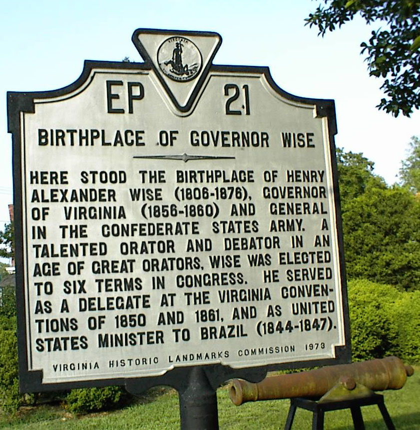 Photo by Millard J. Driscoll
Located in downtown Accomack across from Courthouse.
Wiseville - located w of parksley at end of Rt. 669; post office established 1840 as Hunting Creek and renamed 1855 as Wiseville; discontinued in 1877; later known as Hopkins
Wishart - a small community in ne part of county, on Bogues Bay and e of Temperanceville; post office operated here 1899-1918
Withams - located w of Oak Hall on Rt 703 and 693; named for Charles and Mel Witham who had a sawmill at Jenkins Bridge
Woodlawn - see Metompkin
Woodstock - see Lee Mont
Woman's Bay - small body of water in ne part of county at mouth of Assawoman Creek and w of Wallops Island
X
Y
Young Creek - a large creek flowing into Beasley
Bay, nw part of county,
Z
Zare Point - a point located on the western tip
of Jacks Island
Return to top of this page
Return to top of Accomack County Index
Go to Northampton County Gazetteer
Go to Gazetteer Index Page
Return to the GHOTES home page
Go to Eastern Shore Map Page
Copyright © 1996 Most recent revision 29 October 2003 (wls)


